Southern Xinjiang Travel Guide: A 4,000-Mile Journey into the Soul of China's Wild West
Meta Description: Discover Southern Xinjiang's hidden wonders—from the crimson ridges of the Pamir Plateau to the ancient Silk Road soul of Kashgar. This 13-day itinerary reveals volcanic craters, turquoise lakes, and Tajik culture. Plan your epic adventure today.
Introduction: Why Southern Xinjiang Beckons the True Traveler
We won't ask how many properties or luxury cars you own. Instead, we ask how many mountains you've crossed, how many oceans you've sailed, and how many distant lands you've reached. If your soul yearns for a truly epic journey, then Southern Xinjiang—a land sculpted by wind, sand, and time—is quietly waiting for you.
Southern Xinjiang (Nanjiang) lacks the glittering prosperity of inland China or the cutting-edge development of coastal cities. But precisely because of this, it possesses a unique charm. There's a well-known saying about Xinjiang: "For scenery, go to Northern Xinjiang; for culture, go to Southern Xinjiang." In my view, however, this saying is only half true. Southern Xinjiang's "lonely smoke straight in the vast desert" carries a haunting beauty and frontier romance, not to mention the profound heritage of the Silk Road, the rich ethnic traditions, the boundless Taklamakan Desert, and the majestic snow-capped peaks of the Pamir Plateau.
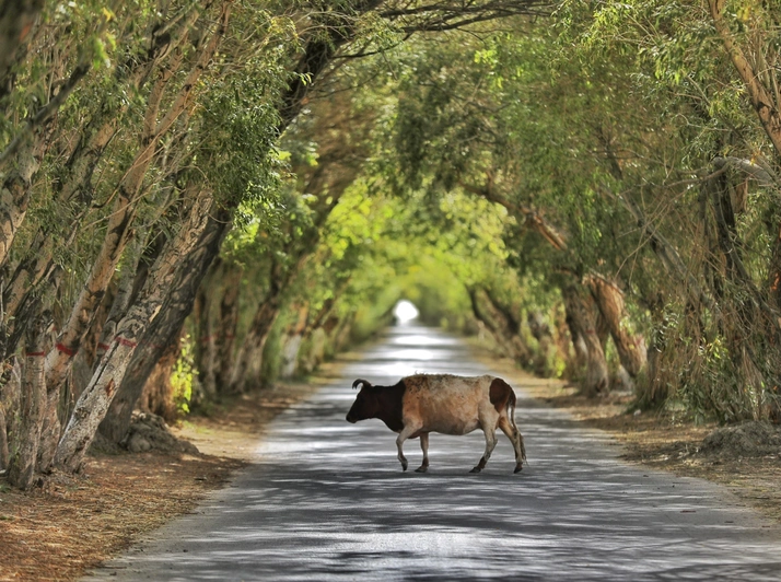
Watching poplar trees intertwine with yellow sand on the Desert Highway, gazing at snow-capped mountains on the Pamir Plateau while experiencing the simplicity of the Tajik people, immersing yourself in Uyghur life in Kashgar and Hotan, and exploring Silk Road relics in Kuqa—these experiences will captivate you. You long for them before you arrive, and you can't bear to leave once you've seen them.
Travel itself—and indeed, many things in life—has no inherent "meaning." But it is precisely these seemingly meaningless moments that weave together into a vast net, connecting memories and the traces of sand brushing against your toes, shining brightly in your mind and lingering in your heart long after.
Southern Xinjiang Travel Itinerary: 13 Days in the Wild West

Destination: Southern Xinjiang (Nanjiang)
Travel Dates: September 7–19, 2018
Cost per Person: Approximately 20,000 RMB
Travel Companions: With friends
Best Time to Visit: September–October (autumn colors, mild weather)
The Crimson Ridge: A Hidden Gem in the Pamir Mountains
Three Hours in a 4x4, Arriving at the "Crimson Ridge"
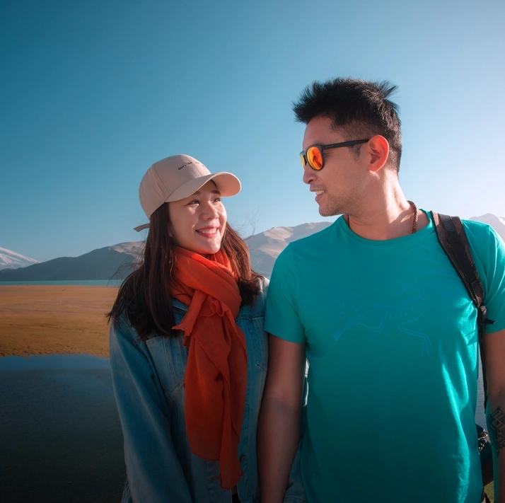
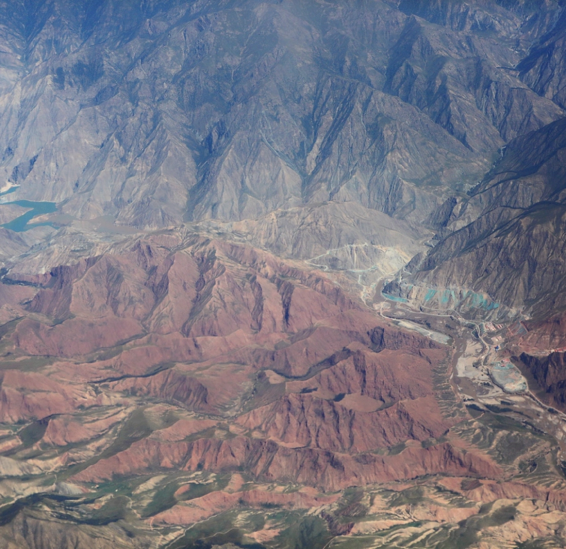
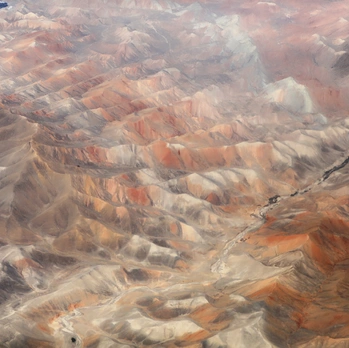
The off-road vehicle bounced along the rugged mountain road for a full three hours before finally reaching a sprawling expanse of red rock formations covering several square kilometers. The rocks here take on myriad shapes—some resemble dinosaur spines, others look like Shoushan stone carvings, some evoke birds in flight, and still others mimic beacon towers. Desolate and uninhabited, the world here is reduced to the sound of wind and silence. I named this place "Crimson Ridge"—a fiery red, spine-like mountain range.
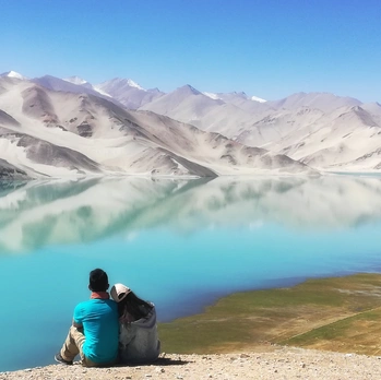
The beauty of travel lies in the fact that you will always find a path along the way that leads to a world you once dreamed of through maps, books, photographs, or legends. You never know when that moment will arrive, but as long as you are patient and persistent enough, it will eventually appear.
Pro Tip: This area is best explored with a 4x4 vehicle. The road is unpaved and requires careful navigation. Bring plenty of water and a GPS device.
[Link: Best 4x4 tours in Southern Xinjiang]
Muji Township: Volcanic Craters and Kyrgyz Culture
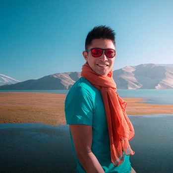
Mud and Sand Ejected from Volcanoes: An Epic Told by the Earth
"Muji," in the Kyrgyz language, means "mud and sand ejected from volcanoes." Here, geologists see the story told by the earth; directors capture alpine grasslands nourished by volcanic ash and the purest ethnic minority culture; and photographers seize this magical landscape in the morning light.
The road leading to Muji Township is a gravel highway, pitted and uneven, with some sections even broken by the erosion of rain and snowmelt. For larger potholes, only a 4x4 can get through. Vehicles are sparse along the way, mostly trucks hauling ore, with almost no tourists. Muji Township is located on the border, adjacent to Kyrgyzstan and Tajikistan, with a border line stretching nearly 300 kilometers. The township has 42 border mountain passes in total, earning it the title "Xinjiang's First Border Township."
A local proverb says: "Ninety-nine bends, nine gobi deserts; if your backside isn't worn out, you won't reach Muji滩." This saying captures the remoteness and difficulty of reaching Muji. Around six in the evening, we finally arrived at Muji Township—a small town with only a few hundred households. The town is mainly inhabited by the Kyrgyz people and has just one main street. Accommodation was basic but clean, with no shower facilities, but in such a remote place, having food and shelter was already quite good.
The "Eighteen Arhats" Snow-Capped Peaks and Kartiemier Volcanic Group
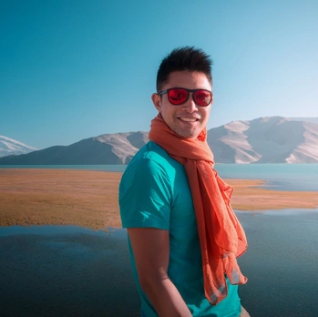
The "Eighteen Arhats" snow-capped peaks lining the Kungai Mountains and the Kartiemier volcanic group are located within Muji Village in Muji Township. The next morning, we got up at dawn and headed straight for the volcanic craters.
About ten kilometers past the checkpoint, there is a lake that locals call Bulunkul Lake. In Kyrgyz, "Bulunkul" means "lake at the foot of the mountain." The lake's water is a pristine blue, untouched by pollution, with lush water plants and flocks of wild birds. Standing by the lake, the distant Kongur Snow Peak and Muztagh Ata Snow Peak are reflected in the clear water, shimmering with silver light, complementing each other. Tall sand dunes and grassy pasture wetlands along the lakeshore add a unique touch to the landscape. Herds of cattle and sheep leisurely stroll across the grassland, making Bulunkul Lake feel even more vibrant and alive.
A Geological Wonder: The Highest Volcanic Crater in Xinjiang
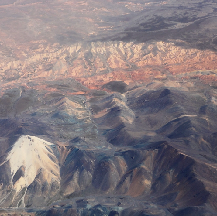
According to research, Muji Township lies near the boundary between the Kunlun Mountains and the Tianshan Mountains. 1,500 years ago, the Pamir Plateau experienced frequent earthquakes, with volcanoes roaring and lava surging. The calcium, iron, manganese, and other minerals that surged from underground back then are still clearly visible on the colorful rocks around the volcanic craters. Looking at these dormant volcanoes of various sizes, you can imagine how spectacular the scene must have been.
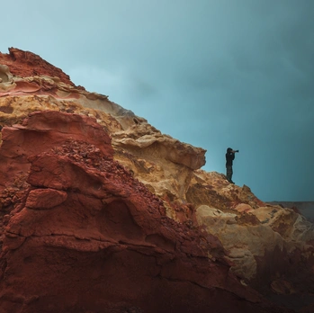
Muji Volcano, officially named the Kartiemier Volcanic Group, is the highest-altitude volcanic crater in Xinjiang and one of the most typical volcanic craters in the world. Here, there are over a dozen volcanic craters of varying sizes, many of which are remarkably well-preserved, scattered at different heights and in different shapes. Some craters are filled with clear, blue water, while outside the craters lies a land of vibrant colors.
In Sanlian Life Weekly, photographer Li Xueliang once wrote: "You must go and see the volcanic crater. With the lens just 45 centimeters from the ground, you can capture an aerial effect... Standing at the crater's edge, smelling the sulfur, and seeing water in the crater, you feel a sense of timelessness."
[Link: Photography tips for Pamir Plateau landscapes]
Kashgar's Jewels: Baisha Lake and Karakul Lake
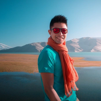
Baisha Lake (White Sand Lake): Where Legends Come Alive
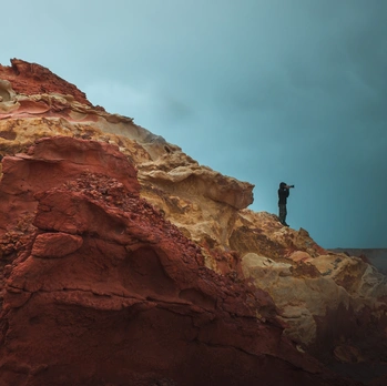
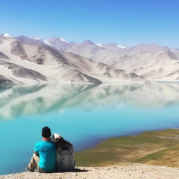
Continuing along the China-Pakistan Highway, we emerged from the steep and treacherous Gez River Canyon, and the view suddenly opened up. A stretch of white sand mountains and turquoise lake water came into view—this is Baisha Lake (White Sand Lake). Legend has it that this is where Tang Sanzang (the monk from Journey to the West) subdued his disciple, Sha Wujing (the Sand Monk).
Two beautiful lakes in Kashgar—Baisha Lake and Karakul Lake—are located right along the China-Pakistan Friendship Highway and are must-see stops.
Karakul Lake: The Black Lake at the Foot of Muztagh Ata
Karakul Lake lies in the eastern part of the Pamir Plateau, at the foot of the "Father of Icebergs," Muztagh Ata Peak, 191 kilometers from Kashgar. The China-Pakistan Highway passes by the lake, which is not far from the base camp for climbing Muztagh Ata. "Karakul" means "Black Lake" in Kyrgyz, and it is a high-altitude glacial moraine lake. The contrast between the dark, still water and the surrounding snow-capped peaks is breathtaking.
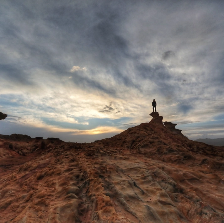
Best Time to Visit: Early morning or late afternoon for mirror-like reflections of the peaks.
[Link: Kashgar to Karakul Lake day trip guide]
Kashgar Old City: Time, Mottled and Melodic
My first impression upon entering Kashgar city was that this border town felt no different from any bustling city in inland China. Wide, straight streets were filled with traffic; lush tree-lined avenues bustled with people; and towering high-rises showcased its modern side. Shopping malls, hotels, and shops were everywhere.
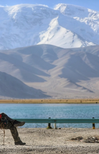
But the real magic lies in the Kashgar Old City—a labyrinth of narrow alleys, mud-brick houses, and vibrant bazaars. Here, Uyghur artisans hammer copper, weave silk, and bake naan bread as they have for centuries. The air is thick with the aroma of spices, grilled lamb, and freshly baked bread. Children run through the streets, their laughter echoing off ancient walls.
Must-See in Kashgar Old City: - Id Kah Mosque – One of the largest mosques in China - Sunday Bazaar – A massive market selling everything from carpets to camels - Old City Alleyways – Get lost in the maze of colorful doors and windows
[Link: Kashgar Old City walking tour itinerary]
Southern Xinjiang Travel FAQ
1. When is the best time to visit Southern Xinjiang?
The ideal time is September to October when temperatures are mild (15–25°C / 59–77°F), autumn colors paint the poplar forests, and the skies are clear for mountain views. Summer (June–August) is also good but can be hot in the desert. Winter (November–March) is extremely cold, especially in the Pamir Plateau.
2. Is Southern Xinjiang safe for tourists?
Yes, Southern Xinjiang is safe for tourists. The region has a strong security presence, and locals are welcoming to visitors. However, always check current travel advisories, respect local customs (especially in religious sites), and avoid border areas without proper permits.
3. What should I pack for a Southern Xinjiang trip?
Pack layers: lightweight clothing for daytime, a warm jacket for evenings (especially in the Pamirs), sturdy hiking boots, sunscreen, sunglasses, a hat, a reusable water bottle, and a basic first-aid kit. If visiting volcanic areas, bring a mask for dust and sulfur smells.
4. How long does it take to drive from Kashgar to the Muji volcanic craters?
The drive from Kashgar to Muji Township takes approximately 6–7 hours (about 300 km / 186 miles), including stops and rough road sections. The last 10–20 km require a 4x4 vehicle. Plan for a full day trip or an overnight stay in Muji.
5. Do I need a special permit to visit border areas like Muji Township?
Yes, some border areas near Kyrgyzstan and Tajikistan require a Frontier Pass (边防证). You can obtain this in advance from your local police station or upon arrival in Kashgar. Always check with your tour operator or local authorities for the latest requirements.
Conclusion: Your Southern Xinjiang Adventure Awaits
Southern Xinjiang is not a destination for the faint-hearted. It demands patience—for bumpy roads, basic accommodations, and long drives. But for those who answer its call, the rewards are immeasurable: volcanic craters that tell the earth's ancient story, lakes that mirror the sky, and a culture that has survived millennia on the roof of the world.
The wind that travels four thousand miles carries with it the scent of sand, snow, and spices. It whispers secrets of the Silk Road, of caravans that crossed these same passes, of travelers who, like you, sought something beyond the ordinary.
Don't just dream of the journey—take it. Pack your bags, book your flights, and let the wind of Southern Xinjiang blow into your soul.
[Link: Book your Southern Xinjiang tour package]
[Link: Recommended Southern Xinjiang hotels and homestays]
[Link: Xinjiang travel insurance options]
Note: This article is based on a 13-day trip in September 2018. Prices, road conditions, and facilities may have changed. Always verify current information before traveling.