Exploring Eastern Nyenchen Tanglha: A Trek Through Sacred Sapu Mountain — A Journey of Snow, Storms, and Self-Discovery
Meta Description: Discover the ultimate Eastern Nyenchen Tanglha trekking guide. Conquer Sacred Sapu Mountain, brave blizzards at 5,100m, and find self-discovery on this remote Tibetan plateau adventure. Expert tips inside.
Introduction: When August's Heat Ignites November's Longing
In the city during August, the heat wave—mixed with the hum of air conditioners—makes you want nothing more than to escape. Amidst the clatter of keyboard keys on a workday, I was already plotting a bigger "escape plan": where to go for the National Day holiday? In recent years, I'd hiked classics like Locke, Wusun, and Dongpo—one iconic route after another. The "hardcore" trails that could truly excite me were becoming fewer and farther between. On well-trodden hiking paths, the holiday crowds surge like a bustling market—hardly satisfying my increasingly picky "adventurer's heart."

Strangely enough, having your standards raised isn't always a good thing. But as Marx once said, the progress of human civilization depends on our ability to use tools. So, after a frantic round of searching, a name jumped into my sight—Eastern Nyenchen Tanglha, Sacred Sapu Mountain.
If you're also tired of the overcrowded "Instagram-famous" routes and long to have a conversation with the wilderness, then this article is for you. Here, you'll find practical Tibetan plateau trekking tips, a detailed Sapu Mountain hiking itinerary, and the raw, unfiltered story of a team that dared to venture where few have gone before.
[Link: Best time to trek Eastern Nyenchen Tanglha]
I. What is Eastern Nyenchen Tanglha? What is Sapu?
Let's start with some background. Eastern Nyenchen Tanglha, the eastern section of the Nyenchen Tanglha mountain range, stretches across the central Tibetan Plateau. It serves as the watershed between the Yarlung Tsangpo River and the Nu River (Salween River). Here, snow-capped peaks stand tall, and alpine lakes (known as tso in Tibetan) are scattered like stars. It's considered the "last pure land" for outdoor adventurers. Pioneers like Shou Dui and Zhongguo Long have blazed trails here, leaving behind countless classic routes.
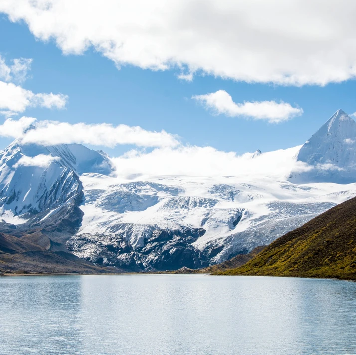
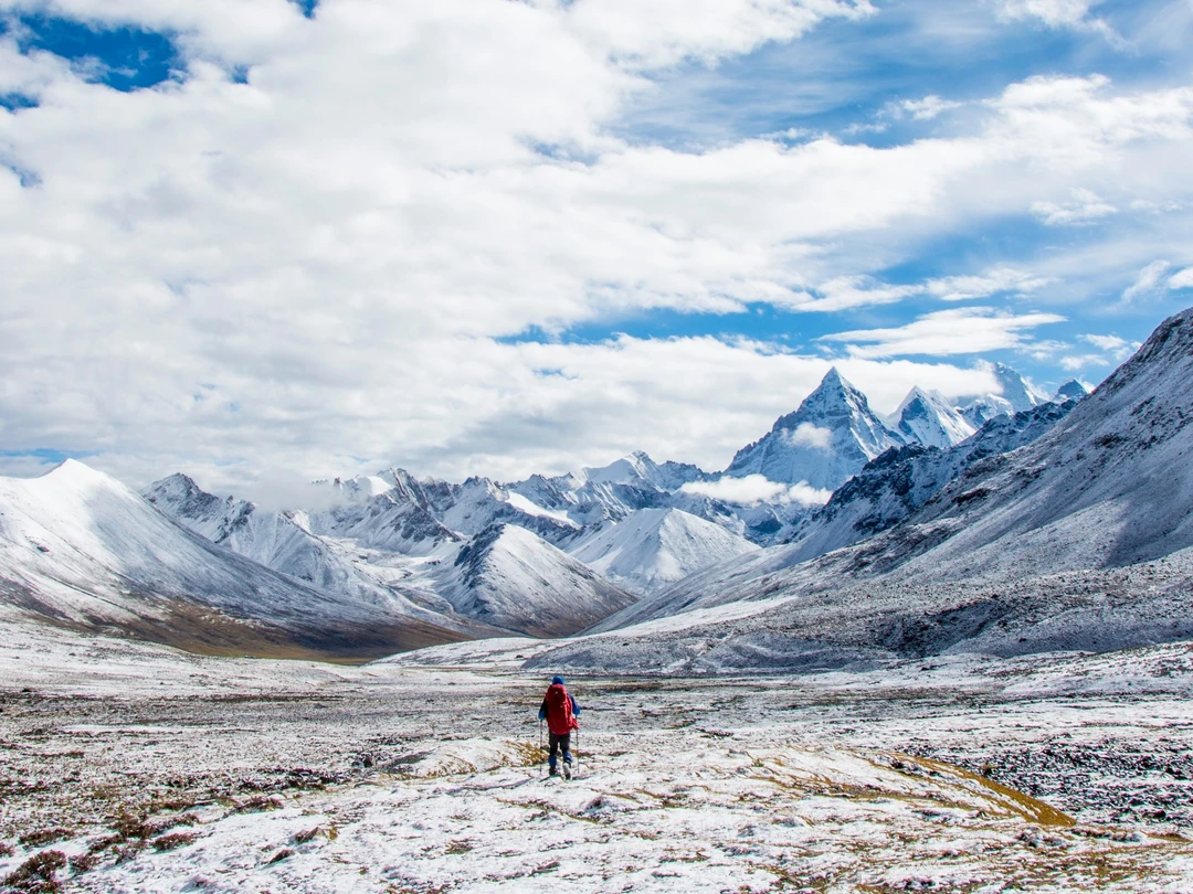
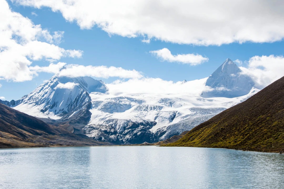
Sacred Sapu Mountain is the "centerpiece" of this region. Its highest peak is called Sepu Gangri, standing at 6,956 meters (22,822 feet), which is also the highest summit in the eastern Nyenchen Tanglha range. If you just want to catch a glimpse of the sacred mountain, you can drive from Yangxiu Township to the shores of Samtso Lake for an easy photo op. But if you're looking for a truly "wild" route, you'll have to hike.
The route we took was the Eastern Nyenchen Tanglha – Sapu Line, designed and completed by the outdoor legend "Gu Yue" in July 2018. It starts from Atokou Village in Lhari County and ends in Jinling Township. Online information is scarce—for outdoor enthusiasts, this is an untouched frontier. This remote Tibetan trek demands serious preparation, but the rewards are unmatched.
[Link: Altitude sickness prevention for high-altitude treks]
II. Gathering the Crew: Rallying the Troops
With the route set, I needed teammates. A call went out, and Song Song and Xiao Y responded immediately.
Song Song was my old teammate from the Wusun Ancient Road trek. On every hike, I like to be in the front group—it lets me take photos at my leisure, watching teammates approach from a distance, then turn and disappear. When I've had my fill of shooting, I speed up to catch up with the front group again. I never tire of this rhythm. But on that Wusun trip, all I captured in my camera were Song Song's back—by the time I climbed up to Akbulak Daban (pass), he had already brewed tea with snow from the pass and was waiting for me, relaxed. That "invincible and lonely" aura has stayed with me ever since.
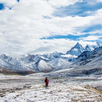
Xiao Y, on the other hand, has been my "go-to writer" for years. Every time we emerge from the mountains, he produces a well-written, humorous, and stylish travelogue, and I just sit back and wait to "borrow his words." Unfortunately, this time work schedules forced him to switch to the Kula Kangri trek instead. I was genuinely disappointed—and now I'm even more so. I once had a teammate who could talk, write, and shoot photos, and I didn't appreciate it. If I had a second chance, I'd say three words to him: You write it!
Later, Ding Yi, Lao Tu, and Lao Yuan joined the team. With that, the group was assembled and ready to go. Building a reliable high-altitude trekking team is half the battle—you need people who can handle both the physical and mental challenges of a remote Tibetan expedition.
[Link: How to choose trekking teammates for Himalayan adventures]
III. Into the Mountains: From the Wuling Magic Van to a Snowy Night
1. The "Wuling Magic Van" on the Plateau
On September 24th, we set off from Lhasa, riding a "Wuling Magic Van" (a legendary Chinese minivan known for its durability) toward Nagqu. We originally planned to camp at Lake Namtso for a night to acclimatize to the altitude, but everyone objected. In the end, we ended up sleeping comfortably in Nagqu, which is even higher.
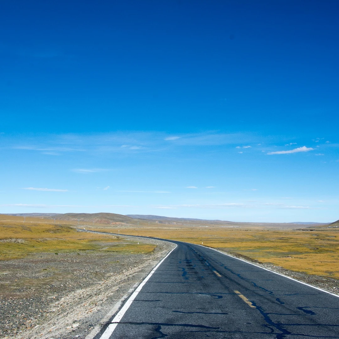
The next day, at first light, we were driving along the plateau highway. The road to Atokou Village shifted from national highway to provincial road, then to township road, and finally to a rough tractor path. On the vast, empty plateau, our Wuling van sped past, startling flocks of field mice and hares, like a breeze rippling the surface of a still pond.
We had lunch in Lhari Town and even encountered Tibetan pilgrims performing full-body prostrations (kora). From Lhari Town to the planned trailhead, it was only about 30 kilometers, but the unpaved tractor path jolted us for over an hour before we finally arrived. This Tibetan plateau road trip was a reminder that access logistics are often the first challenge in remote trekking.
2. The First Night in a Blizzard
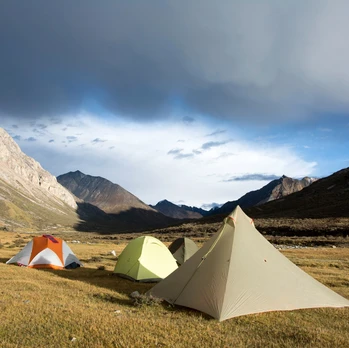
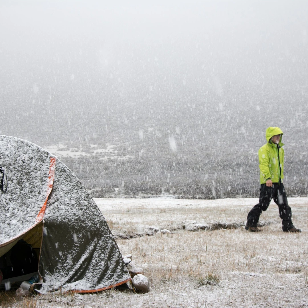
The weather on the plateau changes in an instant. The valley, which had been bathed in brilliant sunlight moments before, was now shrouded in dark clouds. We quickly unloaded our packs, said goodbye to our driver Xiao Wu (who had been with us for two days), and hurriedly set up camp. Soon, gale-force winds and rain came lashing down.
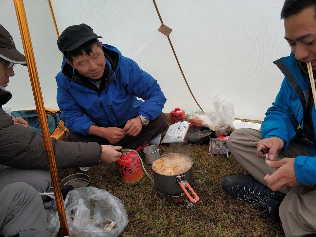
Thankfully, Song Song's "Big A-Frame" tent was spacious enough for all five of us to squeeze in and enjoy a hearty hotpot dinner. After eating and drinking our fill, we dove into the classic topic: "What if we encounter a brown bear?" The conclusion? A brown bear can definitely outrun you—but as long as you're not the slowest, you'll be fine…
After some more banter, we each returned to our tents to sleep. I silently prayed: Tomorrow, let there be good weather. This blizzard camping experience at 5,000m was a stark introduction to the unpredictability of Tibetan mountain weather.
[Link: Essential gear for high-altitude camping in Tibet]
IV. Day 1: The "Red-Letter" Start at Sirong Pass
Today's task was to cross Sirong Pass at 5,360 meters (17,585 feet), then descend continuously, ideally reaching the river valley plain at 4,900 meters (16,076 feet) to camp. Every meter of altitude lost is a strategic victory for sleep quality and altitude sickness prevention.
But Murphy's Law struck—the more you fear something, the more likely it happens.
After breakfast, just as we were about to break camp, a blizzard descended with howling winds. Except for Song Song, who strolled around in the snowstorm like a "snow warrior," the rest of us mere mortals huddled inside our tents, shivering. I thought to myself: If this snow keeps up all day, we might as well skip the hike and retreat directly to Lhasa.
Fortunately, old Murphy doesn't always have the last word. The blizzard gradually subsided, and we finally managed to pack up. By nearly 10 a.m., we set foot on the actual hiking trail.
1. Scrambling Through a Boulder Field
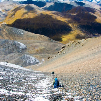
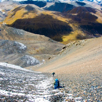
By midday, we finally reached Sirong Tso (Lake). Perhaps because of the weather, this first alpine lake didn't bring much excitement. From Sirong Tso to Sirong Pass, the terrain was a mess of irregular boulders of all sizes, with no clear trail. We had to slowly scramble upward through the rocks.
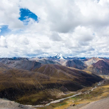
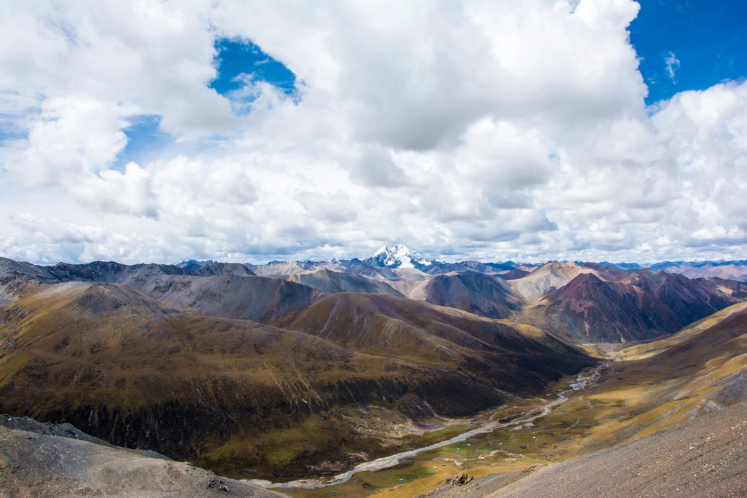
When I finally reached the pass, Lao Tu was already in "photo mode." In the distance, Gong Tso (Lake) lay quietly in view, and behind it, the faint, snow-white peaks—our goal—the Sapu mountain range.
The wind at the pass was fierce, and the weather looked ominous. We didn't linger long before descending into the valley. Sure enough, it wasn't long before hail started falling—white pellets stinging our faces. We found a sheltered spot to rest briefly, waiting for the hail to stop before moving on.
This Sirong Pass crossing at 5,360m was a true test of endurance—a classic high-altitude boulder field scramble that pushed both body and mind.
2. Camping Above 5,100 Meters on Day One
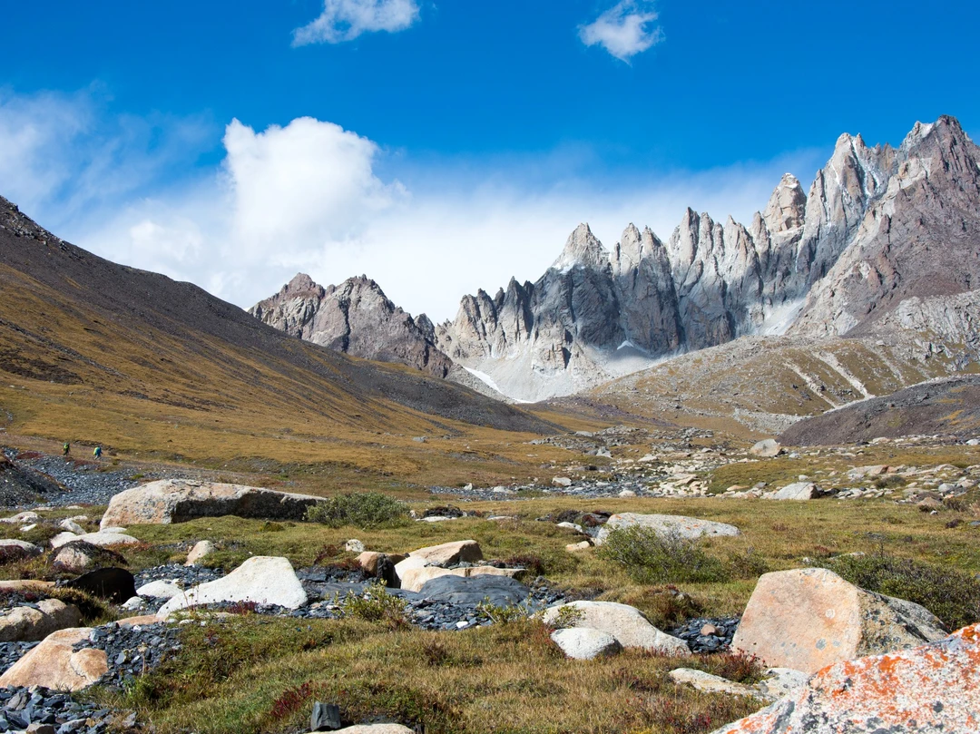
Considering the late hour and bad weather, we found a flat spot and set up camp right there. Our hoped-for 4,900-meter camp was a lost cause. Camping above 5,100 meters on the very first day was a first for me—and for most of the team. That night, sleep was elusive. The wind howled, the tent flapped, and every breath felt thinner than the last. But lying there, staring at the faint stars through the tent mesh, I felt a strange peace. This high-altitude camping challenge was exactly what I'd signed up for.
[Link: How to sleep better at high altitude]
V. The Heart of the Journey: Self-Discovery on Sacred Ground
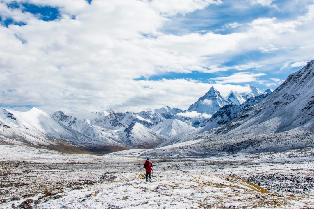
The following days blurred into a rhythm of early starts, relentless climbs, and breathtaking vistas. We crossed unnamed passes, forded ice-cold streams, and navigated Sapu Mountain trekking routes that felt like they belonged to another world. The storms returned, but so did the sun—sometimes within the same hour.
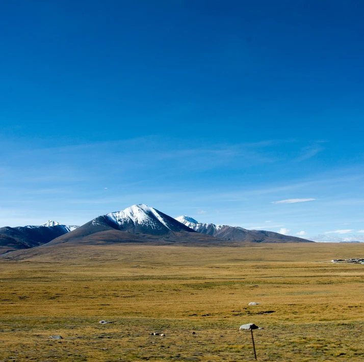
One afternoon, after a particularly grueling ascent, we crested a ridge and saw Sepu Gangri in all its glory. The sacred peak rose like a frozen cathedral, its flanks carved by centuries of wind and ice. For a moment, no one spoke. The silence was profound—broken only by the crunch of snow underfoot and the distant rumble of an avalanche.
This was the self-discovery through trekking I had been seeking. Not in the dramatic, movie-moment sense, but in the quiet realization that I could still push further, still find joy in the struggle, still feel awe in the presence of something greater than myself.
[Link: Mental preparation for multi-day treks]
VI. Practical Tips for Your Eastern Nyenchen Tanglha Trek
If you're inspired to follow in our footsteps, here are some Tibetan trekking logistics to consider:
- Best Time to Trek: Late September to early October offers stable weather, though storms can strike anytime.
- Permits: You'll need a Tibet Travel Permit and possibly an Alien's Travel Permit for remote areas. Arrange through a licensed agency.
- Acclimatization: Spend at least 2-3 days in Lhasa (3,650m) before heading higher. Consider a night at Namtso (4,718m) to test your response.
- Gear Essentials: 4-season tent, -20°C sleeping bag, trekking poles, waterproof layers, and a reliable stove. Don't skimp on boots.
- Navigation: GPS with downloaded maps is non-negotiable. Trails are faint or nonexistent in many sections.
- Team Size: 4-6 people is ideal—enough for safety, small enough for flexibility.
[Link: Tibet travel permits and logistics guide]
FAQ: Your Questions About Trekking Eastern Nyenchen Tanglha
Q1: How difficult is the Eastern Nyenchen Tanglha trek?
 A: This is an advanced, multi-day trek requiring excellent fitness, prior high-altitude experience, and self-sufficiency. Expect daily ascents of 800-1,200m, camping above 5,000m, and unpredictable weather.
Q2: Do I need a guide for the Sapu Mountain trek?
 A: While not legally required, a guide is highly recommended. The route is unmarked, navigation is complex, and emergency support is days away. Local guides also handle permits and logistics.
Q3: What is the best season for a Tibetan plateau trek?
 A: Late September to early October offers the best balance of stable weather, clear skies, and manageable temperatures. July-August brings monsoon rains, while November-April is bitterly cold.
Q4: How do I prevent altitude sickness on this trek?
 A: Acclimatize properly (ascend slowly, hydrate, avoid alcohol), consider medication like Diamox, and listen to your body. If symptoms worsen, descend immediately. Our team's first-night camp at 5,100m was risky—plan for a more gradual ascent.
Q5: Can I see Sepu Gangri without trekking?
A: Yes! Drive from Yangxiu Township to Samtso Lake for a stunning view of the sacred peak. This is an easy day trip from Lhasa, perfect for those short on time or unable to trek.
[Link: Alternative day hikes in Eastern Tibet]
Conclusion: The Trail Calls You
As I sit here, back in the city, the hum of air conditioners and the clatter of keyboards feel distant—almost unreal. But the memory of that blizzard night, the taste of snowmelt tea at Sirong Pass, and the sight of Sepu Gangri at sunset remain vivid. This Eastern Nyenchen Tanglha trekking guide is more than an itinerary—it's an invitation.
If you're tired of the crowded, the curated, the predictable—if you feel that pull toward the unknown, that longing for a sacred mountain journey that tests your limits and rewards your spirit—then answer the call.
Start planning your adventure today. Research the route, gather your team, and prepare for the challenge of a lifetime. The mountains are waiting, and they don't care about your Instagram feed. They care about your courage, your respect, and your willingness to step into the storm.
Ready to trek? [Link: Book a consultation with our Tibet trekking experts] or [Link: Download our complete Sapu Mountain trekking checklist].
The trail begins where the road ends. See you at the pass.
You may also like